We have lived through the snowpocalypse, now it is rain:
Aimed more at California and Oregon than here but who knows - scheduled to hit sometime tomorrow (Wednesday) From Cliff Mass:
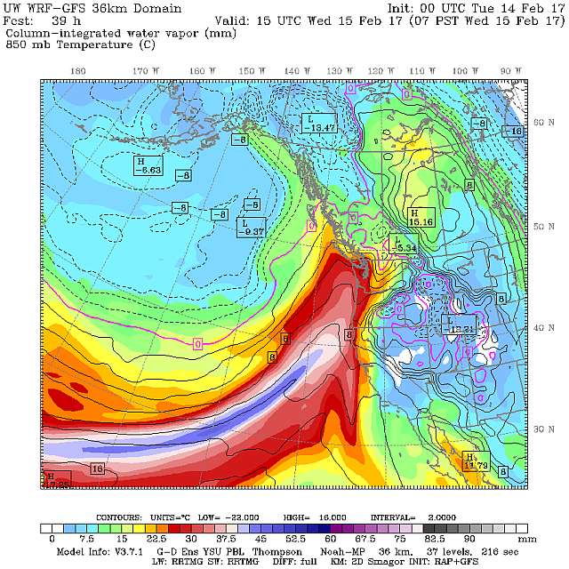
The West Coast Will Face An Extraordinarily Wet Period
Northern California is experiencing its wettest winter on record, with reservoirs full, the ground saturated, and many of the rivers at or near flood stage.
Oroville Dam, northeast of Sacramento, is on the brink of failure and downstream residents have been warned to evacuate. Water is being released through the emergency spillway in a desperate attempt to save the dam.
During the past two weeks, immense amounts of precipitation has fallen over the West Coast (see image), with some locations in the Sierra and coastal mountains getting more than 20 inches of water.
A bit more:
Folks, it is not over yet. Although a ridge of high pressure temporarily has dried things out the last few days, the fire hose of rain will be returning on Wednesday.
Here is the forecast precipitation total for the next 9-days from the U.S. GFS model. Nearly all of the Cascades, Sierras, and coastal mountains will get 5-10 inches of additional precipitation. This includes the last hold-out from serious wetting, the mountains behind Santa Barbara.
And more to come.

Leave a comment