This time of year, we can get warm fronts passing through that originate a long way away -- generally over Hawai'i -- hence the name.
We are staring down the barrel of this one:
We have had quite a bit of heavy shower activity over the lowlands as well as snow in the mountains, but a period of heavier rain, particularly in the mountains, is on tap for later this weekend.
The first part of Saturday will actually be quite decent, but the action starts later that day as an unusually strong and well formed warm front pushes north across the region (see graphic).
Behind the warm front there will be a shift to strong, warm ,moist southwesterly flow that is connected to the subtropics -- known as an atmospheric river -- or as we call it here, a pineapple express. It's Wellie time!
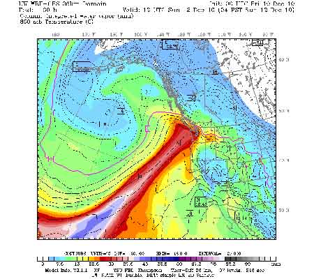
