It looked like we were supposed to get a nice blast of snow but the front moving in is a warm one.
From Cliff Mass:
Flooding Ahead
With the grounds saturated from prolific precipitation during the past week, we are about to be hit hard by several wet systems, including a potent atmospheric river.
Let's start with the predicted precipitation over the next 72 hr from the UW WRF model. Virtually all the mountains get 5-10 inches, with some hit by 10-20 inches. Oregon gets hit particularly hard (in sharp contrast to last year). Even northern CA gets a piece of it.
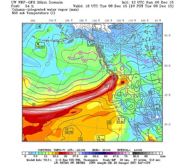
The heaviest precipitation over Washington State will occur on Tuesday as a strong atmospheric river heads right into us. To illustrate, here is a map of the forecast column-integrated wave vapor content (adding all the water vapor in a vertical column of air) at 10 AM on Tuesday. Red and white are high values. You can see the plume of moisture coming from north of Hawaii, straight for us.
An animation representing 84 hours of the forecast model can be found here.
Cliff goes on to deliver some bad news:
Unfortunately for those interested in skiing, the air mass will be warm, and rain will fall over most of the high terrain. Sorry.
Such heavy rain on saturated ground suggests the potential for flooding, and the NW River Forecast Center is predicting widespread flooding over most of the regional rivers west of the Cascade crest (red dots). So be ready.
Well, the season is just beginning...

Leave a comment