An atmospheric river - the second one in a few weeks. Cliff Mass explains:
Major Atmospheric River Period for the West Coast
The weather action is about to move from the eastern U.S. to the western U.S. as strong atmospheric rivers pummel the West Coast with heavy precipitation, with the potential for a major cyclone to strike California later on the weekend.
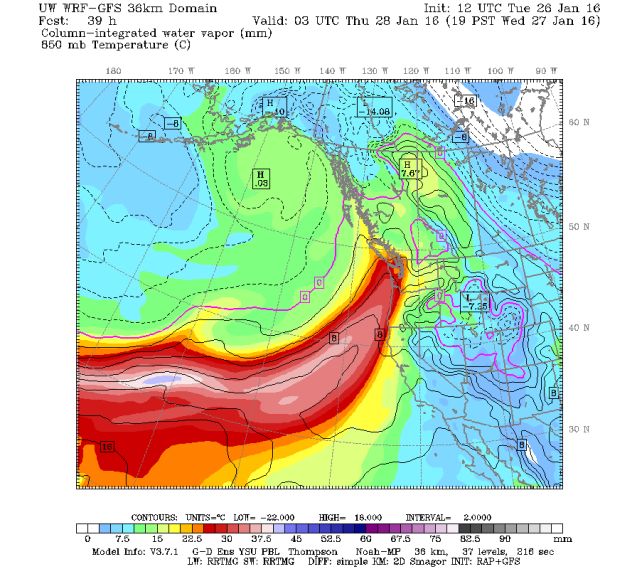
One of the best ways to see plumes of moisture associated with atmospheric rivers is to view the integrated water vapor forecasts: predictions of the total water vapor in a column. Atmospheric rivers are generally warm and juicy....lots of water in the column. And when these rivers hit the western U.S. terrain, heavy rain or snow (at high elevations) can occur.
The water vapor image for Wednesday evening shows an atmospheric river reaching the Northwest.
Here is the forecast for Wednesday evening:
Gonna get wet...
Also, just as a heads up, the place where Cliff gets these wonderful charts is at the Pacific Northwest Environmental Forecasts and Observations at the University of Washington.
Page with the charts: GFS-Initialized Pacific Northwest WRF Weather Forecasts

Leave a comment