Been raining off and on this evening. Got another tenth of an inch for 0.3" in the last 24 hours. Pretty soggy out there. Had three hailstorms move through - lots of little squalls. And then, at 4:40PM, the National Weather Service dropped this little item:
...UNSEASONABLY COLD AND UNSETTLED CONDITIONS IN THE MOUNTAINS THROUGH EARLY NEXT WEEK...
Those venturing into the mountains or traveling through the higher
passes should plan for possible wintry conditions this weekend
into early next week. The main snow level will be around 4000
feet but may fluctuate with heavier showers. Initially through
Saturday night, accumulations will be relatively light and mainly
above the passes.
Another system will arrive on Sunday, followed by potentially
stronger low pressure system Monday into Tuesday. These systems
may bringing more significant precipitation to the mountains.
Snow accumulations in the mountains could reach 3 to 5 inches
above 4500 feet on Sunday. Even higher amounts could fall with the
next system by late Monday into Tuesday. Those planning activities
or travel through the mountains should monitor forecasts closely
over the next several days.
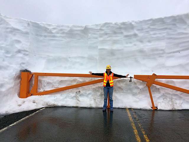
And this is all the while that our Department of Trabnsportation is digging out the mountain passes trying to get them open for the summer. Here is a current photo from the WSDOT of the gate leading to Artist Point at the end of the Mt. Baker Highway - this is how much snow is left:

Leave a comment