The United States Geological Survey maintains gages on the major rivers in the USA - these measure height, flow, temperature and sometimes other elements like turbidity and chemistry. The home page for this service is here: USGS Water Resources
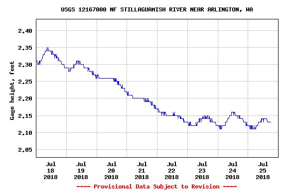
What is fun is that Camano Island is very close to the outflow of the Stillaguamish river near Stanwood, WA. The USGS sensor reports are usually graphs like this - showing the effects of upstream precipitation, snow melt, etc... This is the Stilly near the town of Arlington:
And now, here is the Stilly near Stanwood:
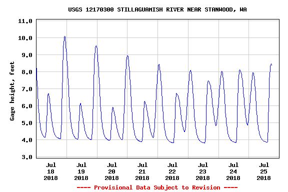
What you are looking at is the back pressure of the ocean tides raising and lowering the river level. I do not know where the sensor is located (I have an idea and am planning to look for it) but it is close enough to the mouth for the tides to swamp any other changes in height.
Fun stuff with numbers...

Leave a comment