A day or so late and headed to the South - from Cliff Mass:
Snow Heads to Oregon, While Western WA Enjoys Cold/Dry/Windy Conditions
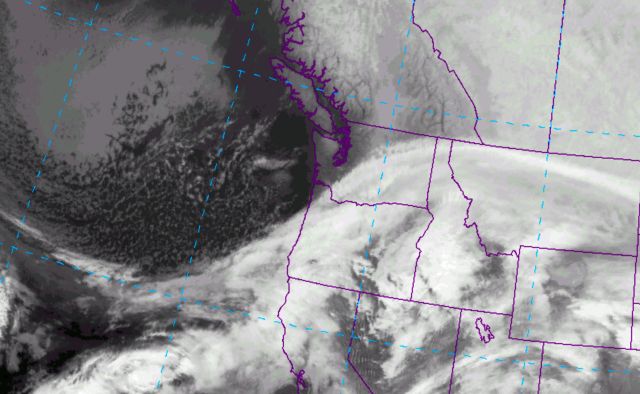
It is now snowing from Vancouver, Washington down to southern Oregon, as a low center moves across the southern part of the state. The infrared satellite picture around 7 AM Monday shows the situation, with a plume of moisture moving northeastward across Oregon and then into southeast Washington.
The forecast for Oregon:
Snow will not get near Puget Sound, but central Oregon will be buried. Here is last nights UW WRF model forecast for total snowfall for the 48 h ending 4 PM Tuesday. In Washington, Walla Walla will get a piece of it, but the real action will be south of Salem. You will not want to go to Eugene, which will resemble Siberia before this over.
And the good news (for Oregonians):
This snowfall is really a gift from the weather gods for Oregon. A month ago, there was substantially below-normal snow pack over the Oregon Cascades. By the time it is over, Oregon will have a normal snowpack. Very good news for water resources, fish, and the ski industry.
All we get is a Frasier River outflow of high winds and much colder than normal temps. Really looking forward to spring.

Leave a comment